Brownstone façades, stoops, and narrow streets make the rowhouse one of New York's most recognizable forms. But "brownstone" is a material and stylistic description; "rowhouse" is a spatial and structural one. My research focuses on the latter: buildings made legible by narrow lots, repeated party-wall construction, vertical domestic organization, and attachment to neighboring buildings.
This distinction matters. A brick, limestone, or stucco-clad house can belong to the same typology. A former one-family house can become two or three dwellings without ceasing to be a rowhouse. The research question is therefore not how one historic aesthetic performs, but how a recurring building system can be adapted again.
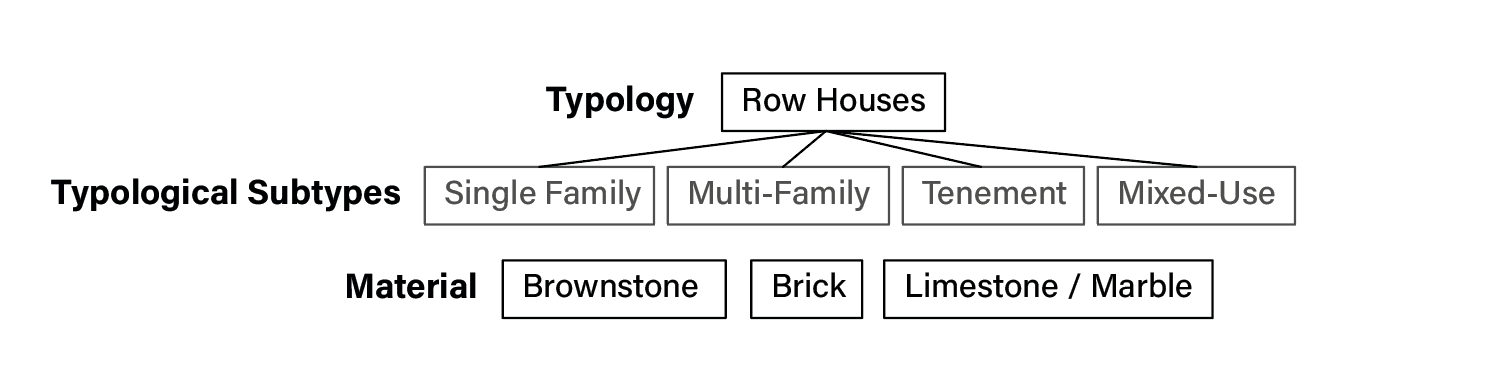
A housing form shaped by repetition
The Commissioners' Plan of 1811 regularized much of Manhattan into blocks and narrow parcels. Lots commonly around 16 to 25 feet wide encouraged a building form that used shared side walls, occupied much of the parcel width, and repeated economically along a street. The resulting house was not conceived as an isolated object. Its performance and construction were tied to adjacency.
Over time, this form absorbed substantial change. One-family dwellings were subdivided; circulation and services were reorganized; kitchens and bathrooms were inserted; and tenement laws imposed new expectations for windows, light, ventilation, sanitation, courts, and shafts. The persistence of the exterior shell can obscure how extensively the buildings changed inside.
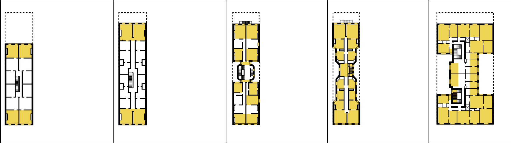
The rowhouse survived not because it remained unchanged, but because its structural and spatial logic repeatedly accommodated change.
What counts as a rowhouse?
For historical and architectural analysis, I use a morphological definition:
A New York City rowhouse is a low-rise residential building on a relatively narrow urban lot, constructed as one unit in a repeated row and attached to at least one neighboring building by a party wall. Its identity derives from attachment, narrow-lot proportion, repetition, and residential scale, not from façade material, architectural style, or present number of dwelling units.
That definition is clear for fieldwork but must be translated carefully for a citywide dataset. PLUTO is organized by tax lot. It contains useful property, dimensional, use, and building fields, including ProxCode, which records whether the assessed building is detached, semi-attached, or attached. Yet PLUTO is administrative data, not a measured architectural survey. A filter can produce a reproducible estimate, not an infallible inventory.
A PLUTO-ready operational definition
Recommended conservative filter
- Residential use:
LandUse= 01, 02, or 03 (one- and two-family; multifamily walk-up; multifamily elevator), with a separate sensitivity layer for mixed residential-commercial lots. - Attached form:
ProxCode= 3. KeepProxCode= 2 in a separate "semi-attached" layer rather than counting it as a rowhouse. - One principal building:
NumBldgs= 1, excluding rear-house compounds and multi-building lots from the primary estimate. - Low-rise scale:
NumFloorsbetween 2 and 5. Test 2 to 4 floors as the narrower sensitivity case. - Narrow frontage:
LotFrontbetween 14 and 35 feet and, where populated,BldgFrontbetween 12 and 35 feet. - Residential occupancy:
UnitsRes≥ 1. For the conservative stock count, cap at 4 units; report 5-to-6-unit and mixed-use attached buildings as an expanded scenario. - Data quality: exclude records with null or zero frontage, floors, residential units, or year built from the primary denominator; report them as unclassified rather than silently deleting them.
| Field | Role | Why it is not sufficient alone |
|---|---|---|
BldgClass | Useful supporting screen: A4, A5, A7, B1, B3, B9, C0, C3, and C5 can contain rowhouse conditions. | Tax classes describe assessed use and type inconsistently; none is a universal "rowhouse" code. |
ProxCode | Best PLUTO indicator of physical attachment. | Does not describe number or length of shared walls and can contain assessor error. |
| Frontage + floors | Captures narrow-lot, low-rise morphology. | Thresholds are research choices and require sensitivity testing. |
YearBuilt | Allows historical cohorts to be mapped. | Age should not define the typology; it should be analyzed after selection. |
Validation: from tax lot to building form
The strongest map should add a second stage using NYC Building Footprints. Join footprints to PLUTO by BBL or spatial relationship, then test whether a footprint touches or lies within a small tolerance of a neighboring footprint along a side-lot direction. Manual review of stratified samples, by borough, building class, age, and edge versus interior condition, can estimate false positives and false negatives.
I would publish three numbers, not one: a conservative estimate, an expanded estimate, and an unclassified count. The map legend should say "rowhouse-like residential tax lots identified by the stated criteria." It should not claim that every highlighted parcel has been field-verified.
Why the definition matters for retrofit
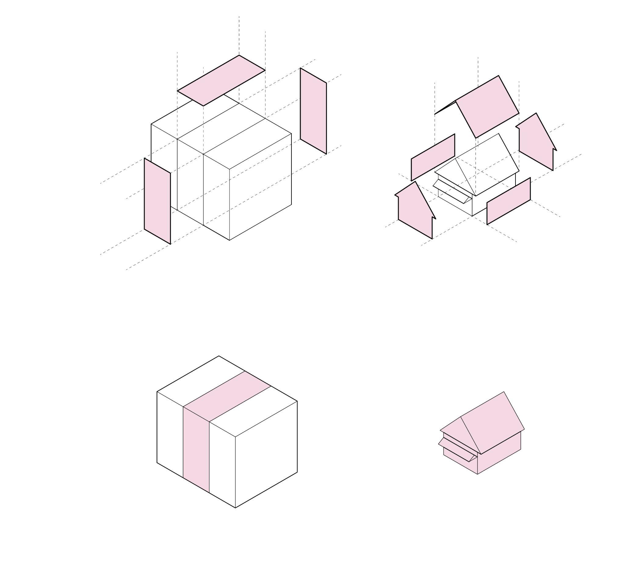
An interior rowhouse shares conditioned boundaries with neighbors. That compactness can reduce transmission losses compared with a similarly sized detached house, while the remaining exposed assemblies, the historic masonry front and rear walls, roof, windows, foundation, and leakage paths, can still drive substantial heating demand. Edge and corner rowhouses behave differently and should be modeled as separate archetypes.
This is why a defensible stock definition is more than a mapping exercise. It establishes the population to which later retrofit findings might reasonably apply, makes variation visible, and prevents one modeled 1901 house from being mistaken for every rowhouse in New York.
Sources and research status
- NYC Department of City Planning, PLUTO and MapPLUTO.
- PLUTO Data Dictionary, including
ProxCodedefinitions. - NYC Department of Finance, Building Classification.
- Jenny (Xin Yu) Ye, Resilient by Design: The Historical Development of the New York City Rowhouse and Proposal for Retrofitting Strategies, 2026.